NDAA Compliant and Affordable
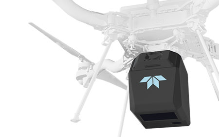
Inertial Labs partnered with Teledyne Geospatial to launch EchoONE, a collaborative innovation that combines Teledyne’s Lidar and camera technology, with the RESEPI sensing solution that leverages our IMU and INS technology. Combining NDAA-compliant data security, lightweight design, and real-time operation to deliver long range, engineering-grade 3D point clouds, EchoONE will drive reliability and return on investment for sensor operators across multiple applications.


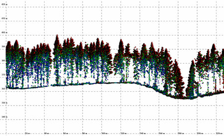
Long Range Canopy Penetration 270 m range to 20% reflectivity targets. |
Wide-Angle Perspective 90 deg × 20 deg field of view, 4 unique vertical scan angles |
Integrated Colorization Camera Integrated 5MP global shutter camera. |
Precise Data 5 mm LiDAR ranging precision |
Ultra-Lightweight Design EchoONE is 1.65 kg |
High-Accuracy IMU Inertial Labs KERNEL-210 tactical grade IMU |

EchoONE is designed and manufactured in compliance with the latest NDAA requirements ensuring data security while competitively priced to less secure options.

Echo weighs just 1.65 kg and can be operated from smaller UAVs such as the Freefly Astro, Inspired Flight IF800 and DJI M300/M350, while operating reliably at a regulatory limit of 120m / 400ft agl delivering ranging precision of 5mm and 0.5mrad 1/e2 beam divergence resulting in clean and precise point clouds.
Full undecimated georeferenced point clouds generated in real-time allowing infield verification combined with rapid post-processing through RESEPI’s “one-click” PC-Master Pro post-processing solution. Full-featured post-processing available with Teledyne Geospatial LMS Professional.
Fill out the form to the right and one of our UAV sales representatives will be in contact with you shortly.